Monday, October 8, 2012

China: Field trip focuses on both nature's destructiveness & beauty

About 30 participants from the 100 or so at the Debris Flow Workshop in Chengdu went on the 4-day field trip following the workshop.  We went took one large tourist bus (complete with aggressive, white-knuckle driver) accompanied by an SUV.  I imagine that more of the Chinese who participated in the workshop didn’t go because of the cost.  For me, the $300 field trip fee was a bargain considering it included meals and lodging. 
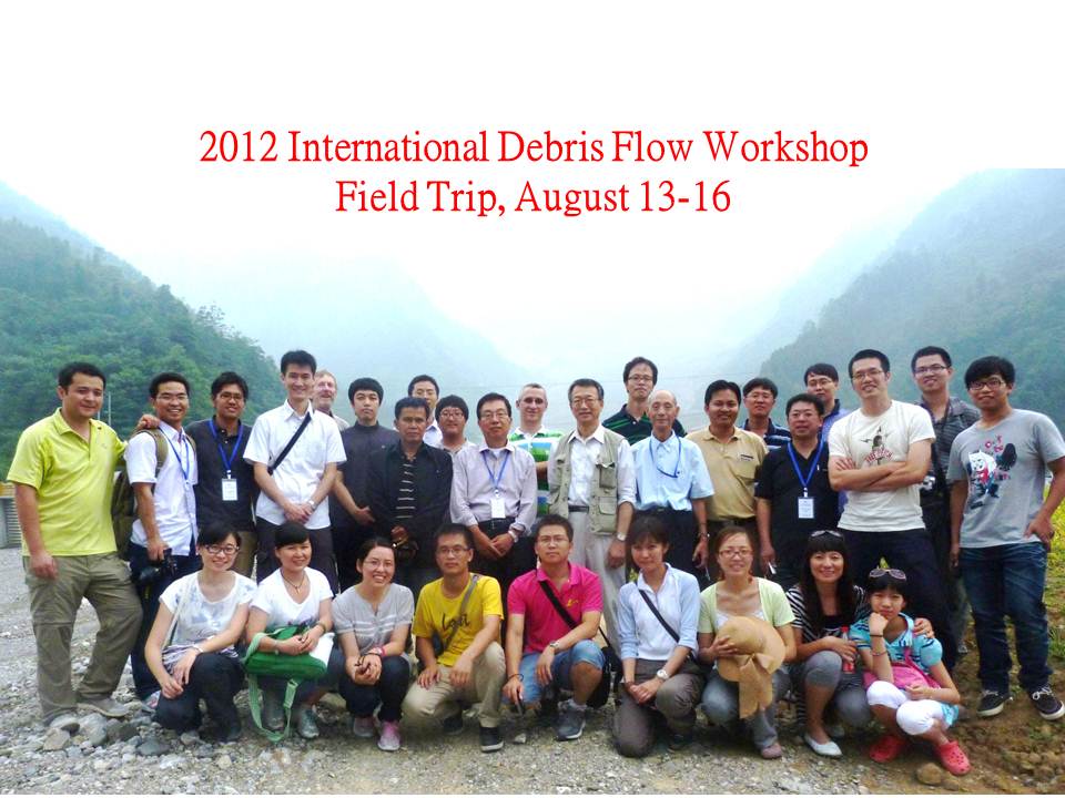
Debris flow field trip participants
Our primary objective was to look at debris flows resulting from 2008 earthquake in Szechuan Province (especially along National Highway 213 north of Chengdu) and mitigation measures to protect against future events.

Aaron Guo from Institute was our technical field guide but we also had a bi-lingual Chinese tour guide who doubled as a stand-up comic.  He told us to call him “James”.  As we left Chengdu (population 13 million) on the morning of 12 August, haze and pollution were blocking the sun as usual.  James said if the sun comes out in Chengdu, it’s so unusual that dogs bark at it.  However, he saw a bright side to the lack of sunshine:  the girls have beautiful skin because they are not exposed to the sun.
With Aaron Guo, a doctoral candidate at the Institute of Mountain Hazards and Environment
and our energetic trip leader.
We headed north from Chengdu on an excellent 4-lane toll road which was built to US or European superhighway standards.  We followed a plain (elevation about 500 meters) east of the mountains in area of small farms with rice and corn crops.  James explained that the collective farms were broken up about 30 years ago and the farmers were given individual plots.
A modern superhighway near Chengdu which I saw
when my plane from Hong Kong was landing.


I noted that highway embankments have concrete cribs planted
with shrubs, grasses, or flowers for permanent erosion control.
We drove into mountains to the small city of Qiangping which was rebuilt after a 2010 debris flow covered it to a depth of 2 meters. In the valleys above Qiangping, we saw newly-installed debris flow control works in Wenjia and Zoumaling gullies. In addition to the structures, there are now sensors in the upper parts of the gullies which will set off an alarm if a debris flow event occurs.

New houses and apartments were built for people
who lost their homes in the 2010 debris flow in Quangping.


New debris flow structures near the bottom of Wenjia Gully.  These structures would provide lines of defense against a really large debris flow event.  However, much of the flow would be diverted higher up on the mountainside to another stream channel which does not itself have debris flow potential.


In Zoumaling gully, Chinese engineers took a composite approach
to debris flow management including diversion check dams
and this large stormwater detention basin created
next to the river above Qiangping.
After visiting Qiangping, we traveled back to the south and around Chungdu to Dujiangyan (population 2 million) where we spent the night at a hotel.  Half of the city’s homes were destroyed or rendered unlivable by the 2008 earthquake. 
Fortunately, this beautiful pagoda in Dujiangyan
was not affected by the 2008 earthquake.
The next day we travelled back into the mountains visiting the small city of Ying Xiu which was rebuilt after the 2008 earthquake.  The middle school was destroyed by the earthquake killing 43 students and 8 teachers.  The ruins have been turned into a memorial park by the government as a stark reminder of the awesome force of earthquakes.

A collapsed building at the Ying Xiu middle school forms part
of the solemn memorial which is now visited by many Chinese tourists.
As we travelled north up the Mingiang River valley, I got the impression that debris flows in this part of China may be inevitable.  They are not necessarily the result of human activities but result from steep slopes with naturally poor vegetative cover on the dry (southeastern) side of the mountain range.  The slopes above the densely populated valleys are too steep to be developed for human activity.  The debris flows are triggered when intense rainfall saturates the thin mountain soils and rock debris either shortly before or immediately following an earthquake.  So the effects of debris flows in this area can be mitigated but they probably can’t be completely prevented.

The remains of the lower end of the 300,000 cubic meter Gaojia debris flow that blocked
the Minjiang River creating a flash flood when the dam it created was breached.
A new channel has been cut through the flow material on the right.
The Miancu valley debris flow destroyed several chemical plants in 2011.  Fortunately for the workers, the plants were shut down for a holiday when the debris flow occurred.  However, 125 people in the area became sick from the resulting emissions from this and other affected plants.   
The Miancu valley debris flow covered the lower four floors of this factory building.
Travelling further north through Song Pan County, we reached an area inhabited by Tibetan people.  We saw tea houses and fields of barley and potatoes.  In Chuan Zhu Shi (elevation 3000m), we stopped at a store selling yak meat and other yak products.  Later we crossed a 3690 meter (about 11,500ft) mountain pass near the source of Minjiang River.  Now that we were on the wetter side of the divide, we descended through a lush conifer forest to the mountain tourist center of Jiuzhaigou where we spent the night. 


Yakking it up in Szechuan Province:
Yes, I know it was pretty silly but it only cost about a buck
and I figured the yak didn’t have anything better to do.  
The third day of the field trip was taken up by a visit to Jiuzhai Valley National Park where the limestone bedrock forms the setting for a natural fairyland.  The valley and its two upper forks are occupied by a series of waterfalls, travertine terraces, and multicolored lakes.  The park was very crowded with Chinese tourists but I was very impressed by its management.  No private cars were allowed above the lower end of the park.  Instead, low-emission busses provided transport.  The trails, bridges, and boardwalks were aesthetically pleasing and a large crew of trash collectors made sure that no scrap of paper or bottle remained on the ground for more than a few minutes.  Not that they were very busy.  The Chinese people generally seem to be conscientious about not littering their outdoor spaces.


 Nuorilang Waterfall is just one of many gorgeous features
at Jiuzhai Valley National Park.


The trash collection crew at the park even includes a guy in a motorized rubber raft
making sure no errant bottles remain on the bottom of Five-Colored Lake


The trip back to Chengdu on the last day of the field trip featured
a many-hair-pinned ride on a narrow highway up to a 4200 meter pass
(about 13,700ft). Fortunately the bus’s brakes worked.
I saw numerous red signs like this on the field trip. They are Communist Party slogans.
UPDATE:  I incorrectly said this sign translates to It is important that the party and the people communicate.  I have since learned that was another sign.  This one correctly translates to:
It is our duty to protect the roads. Anyone who destroys the road should make compensation according to the law.
I’m generally not much for guided tours but given the linguistic and logistical challenges of travelling in China, this tour was the only practical way to see some outstanding examples of Mother Nature’s destructive and creative powers. It also provided some exposure to Chinese culture and infrastructure in places visited by few Western tourists. Furthermore, my colleagues were polite, gracious, and good company. Fortunately, we had none of those chronic-complaining or overly-talkative Americans or Europeans that have spoiled tours for me in the past.
Back in Chengdu at the end of the field trip, we hit atrocious rush hour traffic
which overwhelmed even this wide boulevard.


Sunday, September 30, 2012

China: Highlights from Some of the Debris-Flow Workshop Presentations

The International Debris-Flow Workshop in Chengdu, China (August 2012) included about 40 speakers from China and several other countries presenting the results of their research.  Included were papers describing debris flows and their consequences, modeling studies, structural measures to control debris flows, and risk assessments.  Following are some items from 12 papers that I found particularly interesting:

Landslide Prevention in Hong Kong (Professor C.F. Lee, University of Hong Kong) 
As I pointed out in a recent blog post, much of the territory of Hong Kong is steeply sloping.  In fact, approximately 2/3 of Hong Kong is hilly or mountainous.  This limits the available area for new building construction for the Hong Kong Special Administrative Region with its population of 7 million.  In the past, Hong Kong was able to expand its area by pushing fill material into the harbour, but this is no longer allowed.

Thus, Hong Kong grows vertically replacing buildings of modest height with taller and taller structures.  Many high rises have been located adjacent to steep slopes.  Building codes may protect these buildings from the effects of earthquake shaking but not from large scale slope failures that frequently occur in response to heavy tropical rainfall (3000mm annually – nearly 120 inches).  These slope failures are complicated by the local geology.  Chemical weathering decomposes granite and rhyolite (tuff) bedrock into fine grained material.  The sheer strength of this material is greatly reduced by rainfall wetting, and the factor of safety for slopes decreases with multiple storms.       

When slope failures occur adjacent to developed areas, the results can be deadly.  Professor Lee discussed the Po Shan Road Landslide of June 1972 (during a period of heavy rains) when 20,000 cubic meters of material enveloped high rise buildings resulting in 67 fatalities. 

In 1994, a landslide was caused by a cracked water pipe which resulted in saturated soil.  As a result, Hong Kong has subsequently changed out old water pipes around steep slopes.

Over the past 20 years, slope stabilization has greatly reduced both fatalities and damage to structures. Hong Kong engineers have been able to successfully stabilize precarious slopes in populated areas using rock bolts on bedrock slopes, shotcrete to prevent rainfall infiltration, and grid retaining walls.  However, these techniques often produce visually unattractive results.  In recent years, soil nails are more commonly being used in both cut and fill slopes.  This method enables revegetation of slopes creating a more aesthetic appearance.


While visiting Hong Kong before the Debris Flow workshop, I saw some examples
of high rise apartments on steep slopes that Professor Lee spoke about.

Soil nails have been effective in stabilizing slopes in populated areas of Hong Kong.


Structural Measures Against Debris Flows in Japan (Professor Takahisa Mizuyama, Kyoto University)
One of the more common structural measures to counter debris flows is the sabo dam, a large steel structure which is located in the center of a channel which is at risk of debris flows.  These are located perpendicular to the direction of the debris flow and have rock/concrete retaining walls on either side.  Typically, a series of sabo dams will be located along the channel.  The dams at the upper end will have large openings and will capture only large rocks and debris enabling water and smaller diameter rocks and debris to pass through.  Dams with successively smaller openings will be located downstream.  By the time the debris flow reaches the lowest dam, most of the larger materials will be filtered out and some of the silty water will have been retained behind each dam as the openings become clogged with large debris.  The volume and velocity of the water passing through the small openings in the final dam will have been considerably diminished.   
Example of a sabo dam photo from Professor Mizuyama’s presentation.
Following the debris flow, large material and sediment captured by each sabo dam must be cleaned out using heavy earthmoving equipment and teams of laborers.  

Another common structural measure in use in Japan is the wire ring net dam which consists of heavy steel cables woven together with large openings.  A shortcoming of these nets is the difficulty cleaning them out after a debris flow.  As a result, they typically must be replaced.

There is always the possibility that a large volume of water will be held behind sabo dam debris.  This can result in the sabo dam being overtopped by water or causing it to fail.  Dr. Mizuyama is proposing a modification of the sabo dam which he calls a debris-flow fence.  It allows water to more easily pass through the structure creating a more even flow downstream.

Equivalency principle: bed structures and bed load motion (Zhaoyin Wang, Tsinghua University)
Dr. Wang talked about the importance of the step-pool sequence in streams [sometimes called pools and riffles by fisheries biologists in the USA] to maintain stable habitats and beautiful landscapes.  Bed structures, whether natural or artificial, dissipate energy and reduce erosion.  They reduce bed load motion during floods.  Destruction of bed structures increases sediment transport of streams. 

Wang and his colleagues studied sections of several river systems in China.  In the Yalu Tsangpo (Grand Canyon) in Tibet, they found that bed structures consume most of the flow energy.  There is no bed load transport as a result.  

Artificial bed structures can mitigate the effects of debris flows by slowing their velocity.  In addition, placement of bank stones creates high resistance to flow and protects banks from failure. 

Construction of dams destroys the step-pool system at a cost of many times that of step-pool system construction.  Dams often fail under the tremendous stresses placed on them by debris flows and failure of unarmored banks adds to the debris flow volume.   
Professor Zhoayin Wang of Tsinghua University (China)
spoke about technical aspects of bed load motion in rivers.
Formation Mechanism and Risk Control of Catastrophic Debris Flow Hazards (Peng Cui, Institute of Mountain Hazards and Environment, Chinese Academy of Sciences or CAS)
In 2010, Debris flow events in China were 10 times the normal average and resulted in 2909 deaths.  This large number was primarily the result of the Wenchuan Earthquake.  However, there are a number of factors contributing to the number, size, and destructiveness of debris flows:
- Climate change has resulted in more unusual weather events and intense rainfall.
- Glaciers in Tibet are melting therefore enlarging lakes and enlarging river flows.      
- A strong earthquake results in unstable slopes.
- Cascading dam failures enlarge debris flows by providing more water and materials. 
- Urban development occupies floodplains reducing the area available to accommodate floods.

Following this disastrous year of debris flows, the Institute of Mountain Hazards and Environment initiated a research project to look closely at the debris flows and flash floods that occurred.  They also performed risk assessments evaluating predicted locations of future events and their potential impacts.
Debris flows in China are serious business.  Note that one debris flow
in Gansu province in 2010 caused 1765 deaths. (slide from Dr. Peng Cui’s presentation)
Empirical Relationships for Post-quake Debris Flows in Wenchuan Earthquake Zone (Kaiheng Hu, Institute of Mountain Hazards and Environment, CAS)
Debris flows can last from a few minutes to several hours.  Their magnitudes relate to the size of the supply.  There are two types of debris flow basins:  rainfall-dominated and supply-dominated.

In the USA, debris flows are often associated with heavy rains after forest fires and are not earthquake related.
Slide from Dr. Kaiheng Hu’s presentation shows the two types of debris flow basins.
 
Crisis on Flash Flood and Landslide Disasters of Thailand in 2011, (Chinapatana Sukvibool, Land Development Department, Thailand)
Landslides in Thailand have increased sharply since 1970.  In 2011, disastrous landslides, debris-flows, and flash floods occurred in river basins which train south to Bangkok.  Huge floods in the Bangkok region inundated large areas and even flooded the airport.  A total of 4.4 million hectares (11 million acres) in Thailand were flooded in 2011 resulting in 65 of Thailand’s 77 provinces being declared disaster zones.

Thailand is adopting strategies for flash flood and landslide mitigation on both a macro and micro scale:
- conservation, reforestation, terracing, and check dams in uplands
- farm ponds, reservoirs, contour barriers, and vertical drainage ditches in lowlands
- use of BMPs (best management practices) such as gabions, wattles (erosion control logs), erosion control blankets, and vetiver grass

2370 Thai villages are at risk of flash floods, debris flows, and landslides but only 404 villages have early warning systems. 

Chinapatana Sukvibool of the Thai Land Development Department
discussed last year’s flash flood and landslide disasters in Thailand.
Debris Flow in a Metropolitan Area - 2011 Seoul Debris Flow (Chan Young Yune, Gangneung-Wonju National University, Korea)
South Korea experienced two large typhoons in the summer of 2011 with intervening large rain events and record precipitation for the year.

In July, following a day of 359mm rain (14 inches), a series of debris flows occurred simultaneously in all directions from Umyeon Mountain located on the south side of Seoul (South Korea’s capital and largest city).  It affected the city center and neighborhoods where many wealthy Koreans live. 

Flow velocities reached 28m/second (almost 60 mph) yet slopes averaged only 13 degrees.  These high velocities can be accounted for because of the lubricating effect of the wetted sediments.

Professor Yune and his colleagues have been conducting a real scale debris flow experiment in the field to better understand local debris flows and their predictability.

Professor Chan Young Yune spoke on debris flows
that occurred in the Seoul area in 2011.
 
Engineering Technology Against Large Debris Flow in Wenchuan Earthquake-hit Area (Xiaoqing Chen, Institute of Mountain Hazards and Environment, CAS)
Dr. Xiaoqing Chen pointed out there has been less research in engineering methods to prevent disasters than post-disaster studies.  He discussed and illustrated the different types of dams used to control debris-flows.  While dams may not stop debris flows, they can control their magnitude and prevent blockage of rivers and the subsequent flash floods when debris flow dams are breeched. 

Example of a frame check dam used to control debris flows.
(from Xiaoqing Chen’s presentation)

I was astounded to learn that one debris-flow had a measured thickness of 50 to 80 meters (160-260 feet)!  During our field trip a few days later, I saw evidence of a flow that reached the fourth floor of a building.

Dr. Xiaoqing Chen made a passing reference to “ecological methods” for debris-flow control.  Because most of the speakers had focused on structural methods, I asked him about “ecological methods” during the Q&A period following his presentation.  Did they plant local (endemic) species, I wondered.  He assured me they did.

Mitigation Measures Against Debris Flow in the Giampilieri Area after the Event of October 2009 (Marco Deana, Geobrugg Italia)
On October 1, 2009, 300mm (12 inches) of rain fell in five hours in the northeast corner of the Italian island of Sicily.  This followed another heavy rain a few days earlier.  The vulnerability of the steep slopes above the town of Giampilieri was compounded by thin soils over metamorphic bedrock.  In addition, orange groves used to cover the hillsides and helped protect the soil but the groves have been abandoned and many trees have died from neglect.     

The debris flow that occurred on October 1, killed 27 people and destroyed the town’s only access road.  Geogrugg Italia was called upon to recommend mitigation measures to protect against future debris-flows.   The firm executed a plan to protect against 100 year events (greater protection would have been prohibitively expensive).  The recommended measures included: 
-soil nailing
-superficial landslide barriers (steel netting over exposed area)
-debris flow barriers with dimensions based on testing

Each debris flow barriers only took one day to install.  During a subsequent smaller storm, one barrier worked well in containing a debris-flow.
Marco Deana described mitigation measures taken
in the wake of a deadly debris flow in Sicily.
 
High Mobility of Landslides in Volcanic Deposits Triggered by the Great East Japan Earthquake (Fei Cai, Gunma University, Japan)
The Great East Japan Earthquake of 2011 and resulting tsunami was reported extensively in the Western press.  At one location, the tsunami run-up height reached 43.3 meters!  Less well known are the landslides that were triggered by the earthquake particularly in areas of volcanic ash soils.  For example, the Hanokidaira Landslide killed 12 people and destroyed 10 houses below the base of a slope with a clay soil layer between ash layers.  With water concentrating in porous pumice or ash layers just above a low permeability clay layer, an ideal environment is provided for landslides. 

Another example of a catastrophic slide under similar conditions occurred in Las Colinas, El Salvador in 2001.  In this case, an earthquake triggered a landslide in volcanic tephra which killed 586 people.  

Dr. Cai’s team conducted tests on the sheer strength of pumice and clayey soil.  Pumice was found to have a low sheer strength while clay had a high sheer strength.  They concluded that there is a high mobility of landslides in volcanic deposits.  The apparent friction coefficient (ratio of height to the length of run out) is lower than for slides in other types of materials.  It is obviously important to remember this when planning for disaster prevention.
Some grim statistics from last year’s Great East Japan Earthquake.
(slide from Fei Cai’s presentation)
 Initiation Conditions for Rainfall-Introduced Debris Flows Generated by Surface Water Runoff in Landslide Deposits (Jiawen Zhou, Sichuan University)
This presentation looked at the circumstances leading to the destructive 2010 debris flows in the Wenjiagou gully in Szechuan Province and their characteristics. 

The bedrock in this location is mostly weathered limestone and dolomitic limestone. The debris-flows occurred in landslide deposits with thickness of as much as 150 meters.  These deposits were weakly consolidated with wide size distributions.    

Heavy rainfall of 227mm (9 inches) in a short period of time provided ideal conditions for the triggering of debris flows particularly where slopes exceeded 20 degrees in narrow gullies.  Fine particles in the landslide deposits were easily carried by surface water flow which developed into a high-mobility debris flow which was capable of carrying large boulders. 

Changes in Runout Distances of Debris Flows over Time in the Wenchuan Earthquake Zone (Shuai Zhang, Hong Kong University of Science & Technology)
This study looked at methods for quantifying debris flow hazards.  It involved use of remote sensing images with a GIS platform plus field investigations.  It also considered factors such as the probability of people being in an area where a debris flow even occurs and the number of vehicles per second crossing the area.

Dr. Shuai Zhang considered rainfall intensity and duration related to the occurrence and non-occurrence of debris flows at specific locations in order to come up with probability of a debris flow occurring.
UPDATE:  I incorrectly identified the above speaker as Dr. Shuai Zhang.  I have since learned that she is Dr. Hua-li Pan from the Institute of Mountain Hazards and Environment in Chengdu.  She presented a paper titled, The Mechanism of Debris Flow Downcutting Erosion for Movable Bed and Its Critical Conditions.  In her paper, Dr. Hua-li Pan pointed out that debris flows are more erosive than water or even sediment-laden water.


Thursday, September 20, 2012

China: Debris-Flow Workshop Examines Large-Scale, Deadly Erosion Issue

Why a Debris-Flow Workshop?
I’ve been interested in landslides and related phenomena ever since the mid-1970s when I worked as geosciences manager on the Environmental Impact Statement for the completion of U.S. Interstate Highway 93 through Franconia Notch State Park in New Hampshire.  Widening the existing two-lane highway to four lanes would have meant cutting into the toes of landslide scars in the narrowest part of the notch next to Profile Lake.  Our geotechnical engineers concluded that the widened highway would be vulnerable to slope failures without major structural mitigation.  The visual impact of retaining walls, etc. was unacceptable to many local citizens who wanted to maintain the scenic beauty of the park.  As a result, the new highway was narrowed to a two-lane parkway for several hundred feet past the old landslides.  As far as I know, this is the only section of two-lane highway in the entire US Interstate Highway system.

For several years, I have hoped to visit China, but I’ve wanted to travel there in a professional capacity rather than going as a tourist.  Last year, I began to regularly check out the listings of conferences and educational programs on the website of WASWAC (the World Association of Soil and Water Conservation).  When I saw an upcoming workshop in August 2012 on debris-flows (a particularly deadly form of landslide) in Chengdu, China, I enthusiastically contacted the organizers (the Institute for Mountain Hazards and Environment in Chengdu) for further details.  My application to attend the workshop was accepted and I secured a business visa for China through a passport and visa expediting service in Denver.

Flag of the Peoples’ Republic of China
Map of China with red box around Chengdu (located in the south central part of the country).
But wait!  How could I attend a workshop in China since I don’t even know how to ask for the location of the men's bathroom in Chinese?  No problem – all the workshop presentations were in English and most of the participants could speak some English.  Initially, I was surprised that a Chinese conference would be held in English.  I soon learned that English has become the “lingua franca” (common language) for professionals in East Asia.  The organizers wanted to attract participants from outside China so their only choice was a conference in English. 

The approximately 100 engineers and scientists who attended the workshop were mostly from China but there were also participants from Japan, South Korea, Taiwan, and Thailand.  Only two Westerners attended: an Italian engineer and me.  I was disappointed that I was the only workshop participant from the USA.  Certainly, there are American academics and scientists from the US Geological Survey who have research or applied interests in debris-flows.  It is unfortunate that they are not more actively participating in an exchange of information with their Asian colleagues. 

Top:  Dr. Peng Chi, Workshop Chair, from the Institute of Mountain Hazards and Environment in Chengdu, gave the opening remarks. 
Bottom:  2012 International Debris-Flow Workshop participants (photo provided by the Chinese Institute of Mountain Hazards and Environment)

Debris-Flows Defined
According to the website geology.com, a debris-flow is “a loose mass of mud, sand, soil, rock, water, and air that travels down a slope under the influence of gravity.” (http://geology.com/articles/debris-flow).  One of the workshop speakers, Professor Ko-Fei Liu (Taiwan University) distinguished debris-flows from landslides which are mass movements of solid materials and from mud flows which are viscous and contain at least 60% silt.  Some speakers used the terms “landslide” and “debris-flow” interchangeably indicating the lack of universally-accepted definitions of the terms.


Professor Ko-Fei Liu  of Taiwan University explained the differences between debris-flows and other mass wasting phenomena as part of his presentation comparing two models for assessing granular debris flow hazards.


Relative Seriousness of Debris Flows in East Asia
Debris-flows are a particularly serious issue in China and other East Asian countries.  They also occur in the Western USA, Andean South America, Western Europe (particularly Switzerland and Italy), and India.  Their relatively common occurrence and seriousness in East Asia results from a combination of factors including: 
1. Numerous areas with mountainous terrain characterized by steep slopes and narrow valleys.
2. Frequency of seismic events which act to trigger failures of steep slopes.
3. Bedrock and sediments which are prone to failure (for example, impervious layers of volcanic bedrock which create sliding planes when wet with tropical moisture).
4. Severe rainfall events (sometimes multiple) often associated with typhoons, monsoons, or other summer storms.
5. High densities of human populations in valleys which are vulnerable to debris-flows (hundreds of people sometimes die as a result)
6. Difficulty in relocating populations from debris-flow-prone valleys in the crowded parts of East Asia – where would they go?

Examples of large Chinese debris-flows (photos from presentation by Dr. Jing Zhang, Sichuan University)

Managing Risk and Engineering Solutions
Engineers and scientists in East Asia are modeling debris-flows using empirical-based inputs to predict the behavior and seriousness of future events.  They are also conducting risk assessments to help local officials with disaster planning.   For a number of years, they have been using structural barriers to debris-flows, and they are experimenting with improvements in their design.  However, major events often overwhelm even the best structural methods.

It seems to me that mandatory evacuations would be useful when earthquake activity combined with heavy rainfall conditions point to a high-debris flow risk.  However, I would suspect that such pre­emptive evacuations would be difficult given the typically poor transportation and communications infrastructure in mountainous areas of countries like China. 

Relationship of Erosion Control to Debris Flow Management
Are the techniques used for debris-flow mitigation applicable to erosion control industry?  Yes and no.  Debris-flow events are orders of magnitude larger than the erosion problems we typically deal.  Also, the structural methods used to control-debris flows are more applicable to long-term management of slope stability for mountain highways, etc. rather than short-term measures employed during construction. 

Thus, I think reverse is true:  Erosion control BMPs (Best Management Practices) are applicable to prevention or mitigation of the effects of debris-flows.  For example, improving vegetative cover on debris flow-prone slopes would reduce runoff and stabilize slopes subject to heavy precipitation.  Many of the photos of debris-flows shown in PowerPoint presentations at the workshop showed poorly vegetated slopes.  Hillside terracing would be applicable in some cases.  Diversion ditches along the tops of slopes and slope drains would divert runoff from slopes reducing frequency of saturated soil conditions.  I’m not suggesting that erosion control BMPs should replace engineering structural methods to control debris-flows; rather they could supplement them.  

Coming Next:  A look at specifics from some of the presentations at the debris-flow workshop.

Thursday, September 6, 2012

Bali (Indonesia): An English visionary, his dedicated staff, and a rural community tackle poverty and soil erosion

My old college friend, Bruce Briscoe, is a member of the Ubud Sunset Rotary Club in Bali, Indonesia.  Bruce put me in touch with Sue Winski, another Rotary member, who arranged for me to give a presentation on the SOIL Fund at a Rotary Club meeting while I was in Bali in early August 2012.  Sue also put me in touch with David Booth, an English ex-pat, civil engineer, and founder of the East Bali Poverty Project (EBPP).

A poor community within a tourist destination
Poverty in Bali?  Much of Bali prospers from tourist dollars, and the Indonesian government wants to project a picture of happy Balinese people to potential tourists.  According to David Booth, the Indonesian government had published data in the 1990s claiming that no poverty existed in Bali.  They reasoned that aid organizations working with malnourished children would hurt the island’s image with tourists.  In response to the data, many aid organizations working in Bali pulled out in 1995. 

David had been living in Bali for several years and knew that the government’s rosy image of the island didn’t hold water.  After doing his own research, he identified Desa Ban in the northeastern corner of Bali as the poorest community on the island.  In 1998, he founded the East Bali Poverty Project (EBPP) to provide a comprehensive approach to the economic, social, and environmental problems of Desa Ban.    
David Booth, EBPP Founder and CEO, with his able Balinese assistants, Ketut Suastika (left) and Nengah Ardika Adinata (right).  Nengah and Ketut are wearing jackets and scarves because the morning air (around 20oC – high 60s F) feels cold to Balinese when they ride their motor bikes at 900 meters elevation (2900ft).

Desa Ban’s misfortunes were closely related to the circumstances of its geography.  The community is located between two towering volcanic peaks (Abang and Agung) on slopes averaging 30o (67%).  During the rainy season, it is sometimes hammered by catastrophic floods, while streams disappear during the dry season and the porous volcanic soils lose all the moisture needed to grow crops. 
Mount Agung (3150m – about 10,000ft) provides an idyllic backdrop to the east Bali community of Desa Ban.

Prior to EBPP’s involvement, the villagers eked out a precarious existence growing cassava and maize (corn) and were limited to one crop per year.  There were no roads, no schools, no sanitation, and no health care facilities for the 15,000 people spread out in Desa Ban’s 19 villages over an area of 7200 hectares (18,000 acres). Child mortality was 30-50% before age one and many kids were covered with sores.  Because the nearest reliable springs were too far from the community to provide a regular source of water, people gathered rainwater from their roofs for domestic use.  Rainwater lacks some of the essential minerals needed for human health, especially iodine.  Thus, goiter was rampant in the population and many children suffered from iodine deficiency disease.

Attacking poverty at Desa Ban
After identifying these issues, David went to the community and asked what they needed to improve their lives.  They replied that their top priorities were education for their children and better farming techniques.  Thus, rather than deciding himself what was best for the community, David involved the local people early in the process which gave them “ownership” of the project.

Obviously, attacking such problems took a lot of bucks, and David has been quite successful in finding funding sources such as UNICEF and the British embassy in Indonesia.  He has also raised money by providing consulting services to mining companies, resorts, and other commercial enterprises in Indonesia showing them how to use vetiver grass to stabilize mine tailings and absorb sewage waste.

In the 14 years since the EBPP was founded, the results have been impressive:
- Childhood vaccination rates are now 100% and child mortality has been virtually eliminated.
- 27 health centers have been established in the community promoting tremendous improvements in maternal and child health.
- UNICEF has provided iodine tablets eliminating iodine deficiency-related health problems.
- More than 200 previously illiterate children, ages 6 to 15, attend six schools scattered in hamlets around the community.
- Safe drinking water from three mountain springs now serve 1500 families and more than 850 appropriate technology rainwater collection reservoirs have been built providing a year-round source of domestic and irrigation water.
- Crops have been diversified and up to three crops per year can now be produced.  Organic gardening using worm composting is flourishing on rehabilitated farmland.
- More than 25km of improved roads now link 19 hamlets in the community with each other and the outside world.
- Solar power has been provided to hamlets which have no connection to the electrical power grid.
- Reforestation with bamboo has rejuvenated the local ecosystem and provided a sustainable community industry which produces bamboo for construction uses.
 
“We love you foreigners! Just keep providing
the iodine tablets and vaccinations for our kids.”


Village school in Damaji village. Another dozen years of practice
and she may be on stage in an ornate costume interpreting traditional Balinese dances.
New bridges and improved roads are providing
better access to markets and services for the people of Desa Ban.


Vetiver!
What does Desa Ban’s success in battling poverty have to do with erosion control?  First of all, soil erosion was one of the significant elements related to the community’s desperate situation.  Clearing the mountainsides of their natural protective cover of vegetation to grow cassava and maize had resulted in a loss of the rich volcanic topsoil over time.  With topsoil being gradually being lost by erosion, crop yields had nowhere to go but down.
Sustainable agroforestry on a steep hillside in Desa Ban.

EBPP has greatly reduced soil erosion by the introduction of agricultural terraces which retain water and are protected by vetiver grasses.  Vetiver is valued throughout tropical Asia for its deep roots which do an excellent job of holding soil in place and retaining soil moisture.  Desa Ban has vetiver nurseries where the grasses are started from shoots and eventually transplanted to terraces and slopes which need stabilization.  I saw the effective use of vetiver in the community and was very impressed.  These grasses are providing long-term stability to agricultural land in Desa Ban and have the potential to save millions of tons of topsoil in tropical areas. 

The EBPP website (http://eastbalipovertyproject.org) provides a helpful description of vetiver and its very useful qualities:  Vetiver is a fast growing clump grass with sterile seeds that make it impossible for the plant to spread like a weed.  With a dense and deep root system (penetrates up to 3 meters below the ground surface) it is able to prevent against erosion and landslides.  Through this function, vetiver has also enabled the building of protected roads, fortification of fertile farmland, and flood protection.  Beyond this, vetiver acts as a purifying agent, improving soil fertility and water quality, and is one of the most effective natural methods of carbon sequestration.  Vetiver is also harvested in a variety of ways that can provide building materials and crafts that can be sold to help stimulate the local economy.
Deep-rooted vetiver grass planted along the outer edge of agricultural terraces holds topsoil in place.


I hope that erosion control specialists can find inspiration from the successes in Desa Ban.  Whether we are botanists, soil scientists, civil engineers, geologists, etc., we should contemplate lending our talents to groups working with poor communities in developing countries. 

And by the way, David is looking for volunteer help from a specialist in “rainwater harvesting” if you know anyone with that skill.