Friday, January 25, 2013

China: Corrections to blog posts

I sent copies of my blog posts on the International Debris Flow Workshop to Asian colleagues for whom I have email addresses.  I received several nice replies including one from Rong Zhi Tan who works in Administration at the Chinese Instititue for Mountain Hazards and Environment in Chengdu.  Jane (her English nickname) pointed out three mistakes in my blog posts.  I have made the necessary corrections in my blog posts.  Here they are:

Rong Zhi Tan (Jane) was one of the workshop organizers.  She was a great help to me and speaks excellent English!

My first mistake was the caption on the following photo:

I incorrectly identified the above speaker as Dr. Shuai Zhang. Jane pointed out that this is Dr. Hua-li Pan from the Institute of Mountain Hazards and Environment in Chengdu. She presented a paper titled, The Mechanism of Debris Flow Downcutting Erosion for Movable Bed and Its Critical Conditions. Dr. Hua-li Pan pointed out that debris flows are more erosive than water or even sediment-laden water.

The second mistake was another incorrect photo caption:
I incorrectly said this Communist Party slogan translates to: It is important that the party and the people communicate. Actually, that was another sign. Jane says this one correctly translates to: It is our duty to protect the roads. Anyone who destroys the road should make compensation according to the law.

 
My third "goof" was the date of the Wenchuan earthquake.  It occurred in 2008, not 2010.  See the following photo from the earthquake memorial.  The stone clock shows 2:28 (PM), 2008-5-12, the time and date of the earthquake.


The reason for my confusion was the date of the catastrophic debris flows in the same area.  They occurred in 2010.  See the following slide:

Slide from Dr. Peng Cui's presentation, Formation Mechanism and Risk Control of Catastrophic Debris Flow Hazards lists the debris flows which occurred in China in 2010.  There were two deadly flows in the Wenchuan area occurring one day apart and causing a total of 128 deaths.


Thursday, January 17, 2013

Serbia: Highlights from some of the papers at the 2012 LANDCON Conference

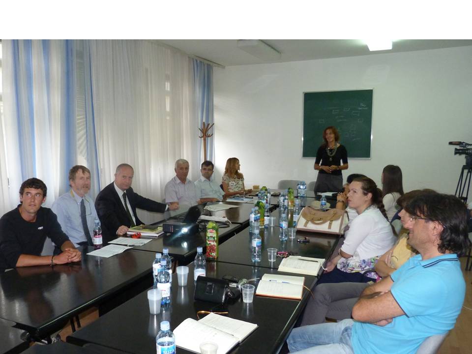
As noted in my last blog post, I attended the “International Conference on Land Conservation” held in Serbia, September 17-21, 2012.  I was honored to co-chair a conference session on “Implemented Global/Regional/National Projects” with Professor Martin Haigh from the UK.  During that session, I presented the results of my survey of erosion control problems in Malingua Pamba, Ecuador on behalf of the IECA SOIL Fund.    

Following are summaries of a few of the papers presented at the conference.  There were numerous excellent presentations, and my selection of those I summarized is admittedly quite arbitrary.  I have tried to include a variety of papers from the countries represented at the conference, the topics addressed, and papers that would be relatively more interesting to erosion and sediment control professionals.   

Landslide Activity and Environmental Change in the Himalaya (Martin Haigh, Department of Social Sciences, Oxford Brookes University, UNITED KINGDOM).  Professor Haigh gave two presentations at the conference.  The first was his conference keynote paper produced in partnership with J.S. Rawat of Kumaun University in Almora, India.  It concerned the numerous landslides and debris flows triggered by the most severe late-monsoon in 60 years (up to 33mm or 1.3 inches of rain per hour) in the Kumaun Himalaya.  This mountain range is located in northern India, west of Nepal.  At least 43 people were killed in these slides in 2010 which caused damage to roads and buildings in excess of US$125 million.

Haigh and Rawat focused their studies on the causes of the occurrence of and damage from 108 of the landslides.  They found that slope steepness and height of road cuts were the greatest contributing factors to landslide occurrence.  Other factors perceived important by the local population such as urbanization, deforestation, road engineering, and geologic structure turned out to be relatively unimportant.

Martin Haigh identified “chance” (the occurrence of an extreme rainfall event) as the principal contributor to the 2010 landslides in the Almora, India area.  Indians refer to chance or fate as an adhidaivic cause of trouble.


Professor Haigh’s other paper, India Abroad:  International Development Projects of India’s NGOs, looked at Indian organizations and movements involved with development projects outside of India.  He focused his discussions on the philosophies behind these groups and their contrast with Western approaches to development.  Martin pointed out that the West is obsessed with the physical aspects of development rather than social.  Indian NGOs approach development from Hindu perspectives such as Ghandian political economics (creating a community that is in balance with its surroundings), Ananda Marg’s development of agricultural cooperatives, and ISKCON (self-sufficient, sustainable, post-hydrocarbon farming).


Sarvodaya is an Indian NGO which follows the Gandhian principles of self-reliance, no harm, and personal ethics.  They are quite active in agricultural development in Sri Lanka.

Torrent Control in the Context of Climate Changes (Johanes Hübl, Institute of Mountain Risk Engineering, Vienna, AUSTRIA). This conference keynote paper presented a detailed program for preventing, mitigating, and responding to heightened environmental risks associated with climate change.  Hübl talked about the need for improvements in cooperation between science and engineering professionals and the public to raise public awareness of these risks.  Other important measures he discussed included hazard maps to identify vulnerable areas, avoidance of construction in sensitive areas, participative planning (including the public), warning tools, and protection of forests and sensitive soils.  


Johannes Hübl looked at the environmental risks associated with climate change  and how to address them.


Conflicting Issues in Controlling Land Degradation and Global Climate Changes (Idefonso Pla Sentis, Department of Environment and Soil Science, University of Lleida, SPAIN).  Professor Pla Sentis presented detailed models showing the complex interactions between soil and water conservation and global climate change.  He pointed out the serious conflict between the need to increase food production for an increasing population and the use of fertilizers, irrigation water, mechanization, and pesticides to achieve these increases.  The problem with these practices is their reliance on carbon-based fuels which produce greenhouse gasses.  Pla Sentis warned us against over-simplifying controls for climate change and soil erosion because no one method works in every area. 

This flow chart from the presentation by Idefonso Pla Sentis points out the complex interrelationships between climate change and impacts to soils.

Effects of Changes in Selected Climatic Factors on Wind Erosion Risks (Jana Podhrázská, Research Institute for Soil and Water Conservation, Brno, CZECH REPUBLIC).  Ing. Podhrázská and five Czech colleagues studied wind erosion of soils in Moravia (eastern Czech Republic).  The team used GIS to produce maps illustrating the correlations between increases in warm, dry weather; light textured soil; and vulnerability to wind erosion.  They estimated that at least 10% of arable land in the Czech Republic is potentially at risk of wind erosion. 
      
In my last blog post, I stated that there were representatives from 11 countries at the conference.  I should have said 12.  My apologies to Ms. Podhrázská and the Czech Republic for neglecting to include them!  I forgot about the Czech Republic because I did not get a photo of Ing. Podhrázská.  By the way, “Ing.” is the abbreviation for the professional qualification for European engineers roughly equivalent to P.E. (Professional Engineer) in the USA.

A Hydrological analysis of a Small Watershed with the Purpose of Erosion Using a Geographic Information System (Tekin Susam, Gaziosmanpaşa University, Tokat, TURKEY).  Professor Susam and two Turkish colleagues used GIS techniques to calculate erosion potential in a small watershed in north central Turkey.  Physical and hydrological inputs included slope, aspect, curve of hypsometry (area-altitude relationship), drainage length, drainage density, stream order, and bifurcation ratio.  They noted that the scale of digital elevation data used has considerable effect on the accuracy of the derived data.

Turkish professors İrfan Oğuz (left) and Tekin Susam (right) used GIS to analyze erosion potential in a small watershed. 

Changes in the Properties of Eroded soils in a Long Time Period (Ilyusya Gabbasova, Institute of Biology, Ufa Research Centre, Ufa, RUSSIA).  Professor Gabbasova and four Russian colleagues studied the aggressive water and wind erosion processes in the southern pre-Ural area, southeastern corner of European Russia (Republic of Bashkortostan).  She noted that the thickness of humus and chemical quality of many of the area’s soils have declined over the past 35 years as a result of agricultural practices and chemical fertilizers.  In order to minimize erosion, it will be necessary to decrease cultivation and increase crop rotation.

Torrents and Torrential Floods in Serbia:  Characteristics and Possibilities of its Control (Ana Borisavljević, Faculty of Forestry, University of Belgrade, SERBIA).  Torrents are defined as small watersheds with steep regimes.  Floods are fairly well controlled in large Serbian rivers but torrent events are more problematic and less predictable.  Ms. Borisavljevic and her two Serbian colleagues found that more than half of torrential floods occur in May and June.  The annual average of these events in Serbia has increased in recent years which they attributed to global climate change.  The research team came up with a plan for control of torrential floods in susceptible watersheds including erosion control measures, check dams, and reforestation.  During the Q&A, I speculated that urbanization may also pay a large role in increased flooding by increasing impervious surfaces which accelerates runoff. 

From the presentation by Ana Borisavljević:  Hideous results of a 2011 torrential flood in Novi Pazar, Serbia.

Sediment Management in the Catchment of the River Ibar in Serbia, Related to the Project of Hydropower System (Slobodan Petković, Institute for Development of Water Resources, Belgrade, SERBIA).  A system of ten dams is currently proposed for the River Ibar but sedimentation of future reservoirs is recognized as a serious associated issue.  Dr. Petković noted that the watershed (7000 km2 area) is characterized by a high percentage of bare lands and steep slopes particularly in upstream areas.  The institute modeled sedimentation based on no erosion and sediment controls and including factors such as slope, sheer stress, and flow regime.  Next, they looked at a combination of mitigation measures including erosion control structures and bioengineering to mitigate sedimentation.


Development of a Prespa Lake Watershed Management Plan (Ivan Blinkov, Faculty of Forestry, Saints Cyril and Methodius University, Skopje, MACEDONIA).  Professor Blinkov was involved with a multinational team in preparing an “ecosystem-oriented” watershed management plan for the Prespa Lake basin which lies within Macedonia, Albania, and Greece.  The “globally-significant” ecosystem within this basin is under stress for a variety of reasons including unsustainable agricultural, fisheries, forestry, and water management practices.  The project was supported by the UNDP-GEF (United Nations Development Programme – Global Environmental Facility Trust Fund) and faced numerous constraints because of lack of available data.  However, I was impressed with the phenomenal volume of data they were able to process given these limitations.  I compared it very favorably with the efforts of the team which developed the Southeastern New England Water and Related Lands Resources Plan which I worked on as a water resources planner in 1973-74 with the New England River Basins Commission in Boston.  We had no GIS programs or user-friendly PCs back then to use in processing our data.  We even hand colored some of our maps.  Resource planning tools have come a long way in 40 years!

The boundaries (dashed lines) of Macedonia, Albania, and Greece meet in Prespa Lake.
Source:  http://prespa.iwlearn.org/

Impacts of Grain for Green Project (GGP) on Soil Erosion in China (Li Rui, Institute of Soil and Water Conservation, Yangling, CHINA).  Dr. Li Rui spoke about the innovative GGP in China which involves planting trees and grass on steep slopes.  Around 14.7 million hectares (36.2 million acres) of steep farmland has been converted into grassland and forest land.  As a result, runoff and soil erosion have been reduced and sediment yields have decreased 45 percent in areas where the program has been implemented.  Despite the loss of farm land, the Chinese are able to get higher grain yields through more intensive cultivation and double cropping in more gently sloping areas.  Moreover, farmers’ per capita net income has increased significantly. 

Much of the steeply-sloping land in this Chinese community has been converted to forest from cropland through the government's Grain to Green program. Photo by Jianguo "Jack" Liu.  Source: http://msutoday.msu.edu/news/2009/peer-pressure-plays-major-role-in-environmental-behavior/
The conference featured poster presentations.  Several posters dealt with applications of erosion and sediment control technology. 

Notice that the above poster incorrectly says “Faculty of Fores” rather than Faculty of Forestry.  The entire conference was in English, the conference abstracts were published in English, and even the posters (many from Serbian graduate students) were in English.  Obviously, some of the speakers had difficulties with English (only Professor Haigh and I were native English speakers).  And yes, I got some good-natured chuckles (to myself) at some of their linguistic faux-pas.  However, I greatly admired the efforts at English communication of the Serbians, Russians, Turks, Chinese, and others at the conference whose native languages differ greatly from English.  Sure, I know they study English in school, but I kept wondering how in the hell they were able to do as well as they did! Smarter than me, I guess!

Coming next:  My mad dash across southern Europe by train - part 1

Thursday, January 10, 2013

Serbia: A Global Perspective on Soil & Water Issues


My travels and meetings in southeastern Europe have been detailed in my last eight blog posts and included visits to Serbia, Montenegro, Bosnia & Herzegovina, Croatia, Albania, Hungary, and Romania.  The central event which drew me to this region of Europe was LANDCON 1209 (the International Conference on Land Conservation:  Sustainable Land Management and Climate Changes) held in the Danube Region of Serbia, September 17-21, 2012.
 Route of our bus trip from the University of Belgrade to conference site on the Danube River
The conference was organized by the Faculty of Forestry at the University of Belgrade (Serbia) which ably arranged for the conference venue and handled the myriad of logistics necessary to host such an event.  There were also several co-organizers, the most significant of which was the World Association of Soil and Water Conservation (WASWAC or WASWC).

WASWAC was founded in 1983 as a forum for soil and water conservationists around the world.  It was originally based in the headquarters of a US organization, the Soil and Water Conservation Society (SWCS), in Iowa but has since relocated to the Institute of Soil and Water Conservation in Yangling, China.  In the words of its current president, Dr. Li Rui, WASWAC has devoted itself to a worldwide promotion of the application of wise soil and water management practices that will improve and safeguard the quality of land and water resources.  WASWAC currently has around 5000 members from 120 countries.  It publishes a monthly Hot News, a quarterly journal (Bulletin), and books (periodically).  Every three years, WASWAC hosts a World Conference.  The next one will take place in Bangkok, Thailand this May (http://www.ldd.go.th/web_waswac2/index.htm).  WASWAC also sponsors an international cooperation program, holds training courses, and hosts a student forum.

From WASWAC President Li Rui’s presentation, Brief Introduction of World Association of Soil and Water Conservation.  I felt there was a message to IECA in their future objectives which I underlined in red.

WASWAC (like its original “parent” organization, SWCS) seems to primarily focus on soil and water conservation related to agriculture.  It is also more of an academic and research-oriented organization in contrast to IECA which focuses more on applied erosion and sediment control related to construction projects.  Therefore, it appears that the two organizations are complementary rather than competitors.  I came away from LANDCON 1209 with the impression that our respective memberships have much to learn from each other.  A number of the papers presented at the conference involved research on the nature of erosion and sedimentation, modeling, climate change, water quality, agricultural water and soil issues, as well as erosion and sediment control techniques similar to those employed by IECA members who work in the erosion and sediment control industry.  

The conference venue was a comfortable (but not lavish) resort hotel in the Serbian town of Donji Milanovac located in Đerdap National Park (that D with the line through it is kinda pronounced like a J) along the Danube River gorge and across the river from Romania.  It was attended by professors, other environmental professionals, and students from at least 11 countries (by my count).  From introductory remarks by the forestry school dean and park director, I learned that Đerdap National Park is the largest of Serbia’s five national parks including 65,000 hectares (over 250 square miles) and following 50 miles of the Serbia-Romania border along the Danube.  Its biological diversity includes 1,100 plant species, 200 birds, 50 mammals, and 60 fish.

Note:  Some countries had several representatives at the conference so I just arbitrarily choose people for the above collage for whom I had a relatively good photo.  Correction on January 14:  There were actually at least 12 countries represented.  I forgot Jana Podhrázská of the Research Institute for Soil and Water Conservation in the Czech Republic.  Unfortunately, I failed to take her photo.
Dr. Miodrag Zlatić (the ć is pronounced like ch) was the President of the Conference Organizing Committee and a Past President of WASWAC.  He was the jovial forestry professor who picked me up at the Belgrade airport two weeks before the start of the conference and took me a Belgrade bar where we enjoyed (in his words) “glasses of conversation.”  

In his introductory remarks to the participants, Miodrag spoke about the importance of these LANDCON (which stands for “land conservation”) conferences.  He talked about the huge area of forest and grassland that has been lost to human development since the beginnings of agriculture and noted that the rate of loss is accelerating.  However, “we are here because we are optimists”, Miodrag added.  He also spoke of the importance of involving young people in soil and water conservation.  This latter remark was most fitting given the large number of natural resources students (mostly from Serbia) who attended the conference.  Miodrag felt that we are very knowledgeable about the technical aspects of soil and water conservation, but we need to better understand its social aspects.  For example, “What do farmers think about conservation measures and what they have used historically?”  Soil and water conservationists also need to look more toward problem solving such as the use of structural measures.  And I thought to myself, “This is an area where IECA professionals have much to contribute”.


Miodrag also introduced attendees from various countries and organizations.  The exuberant representative from Macedonia, Dr. Ivan Blinkov, even presented him with a bottle of Macedonian wine.  I was introduced as the representative from IECA and conveyed my wishes for greater cooperation and coordination between IECA and WASWAC. 

We then had a very interesting presentation from Dr. José Rubio, chair of WASWAC’s International Cooperation and Development Committee.   José works at the Center of Investigations on Desertification in Valencia, Spain.  He spoke about the “Global Soil Partnership”, a 2011 initiative of the UN Food and Agriculture Organization (FAO).  

In his presentation on international initiatives involving soil conservation,
José Rubio led off with a simple message to grab our interest.

José pointed out that many contemporary world problems are related to soil.  When one considers that an already overcrowded world is becoming ever more crowded (mostly in developing countries), an adequate food supply is critical to ultimately preventing mass starvation.  The challenge is to preserve soil while improving agricultural productivity and food supply.  Thus, UN FAO member states have developed a Global Soil Partnership (GSP) with the vision of healthy and productive soils for a food-secure world.  The mission of the GSP is to protect and enhance soil resources through both technological innovation as well as the development of best practices, standards, and guidelines. 

While human population has leveled off in developed countries, the world’s population is projected to skyrocket to 9 billion by 2050 with all growth coming in developing countries. The implications for resource depletion (including water and soils) are sobering.  Slide from José Rubio’s presentation.

This is nothing new for the UN FAO.  In 1982, they adopted “a World Soil Charter spelling out basic principles and guidelines for sustainable soil management and soil protection to be followed by governments and international organizations” (http://www.fao.org/news/story/en/item/89277/icode/).  However, as you can easily imagine, there have been delays in applying the charter in many countries, especially those where it is most needed.  José said that a new World Soil Charter is needed with updates addressing new socio-economic, environmental, and demographic realities.  This charter would need to address the challenges of soil biodiversity, the role of soil in a functioning ecosystem, and demographic changes.
In my opinion, these are worthwhile goals.  However, my cynical side tends to get less than enthusiastic about UN initiatives.  The problem is not with the UN itself.  It has to do with rampant corruption and/or misplaced priorities in some of the member states.  How can we hope to improve soil resources, attack erosion and sedimentation, and ensure food security in the neediest countries where ruling oligarchs often manage to suck up aid money intended for community environmental initiatives?  So, let the UN FAO set goals for us to emulate but let’s apply our resources and talents in countries and communities where they won’t be wasted and where they genuinely are welcomed. 

In my next post, I will discuss more of the interesting presentations at the conference.

Top:  On the middle day of the conference, we took a hiatus from presentations and visited sites in Đerdap National Park.  Bottom:  Iron Gate of the Danube River just above the Đerdap Hydroelectric Power Station and dam.   
After the first day of the conference, some of us were invited to a party at a Serbian hunting lodge where we toasted to healthy soils and good friendship!  Top photo (L to R):  Li Rui (China), Miodrag Zlatić (Serbia), José Rubio (Spain), Ildefanso Pla Sentís (Spain).  Bottom photo (L to R):  Csilla Hudek (Hungary), Miodrag Zlatić (Serbia), Ilyusya Gabbasova (Russia), Ruslan Suleymanov (Russia).


Friday, December 14, 2012

Albania: A Possible Opportunity to Provide Erosion and Sediment Control Assistance


Dr. Velibor Spalevic from the Biotechnical Faculty at the University of Montenegro arranged for us to have a meeting with four professionals from the Albanian Ministry of Agriculture, Food, and Consumer Protection.  We met with them at the offices of the Inspectorate of Land Protection in Tirana, the Albanian capital, on September 7. 

I’m speaking about IECA and the SOIL Fund with Arben Mukaj (left) (Chief of the Drainage
and Flood Sector and an expert on irrigation and drainage systems) and Reshit Uruci (center) (Agronomist, Department of Land and Water Management) (photo by Klaas Annys)
 
I was pleased to have a chance to meet them and find out about erosion and sedimentation issues in Albania.  I also wanted to let them know about IECA and the SOIL Fund and explore possibilities of IECA members doing volunteer work in Albania. 

For Velibor, it was an opportunity to acquaint these Albanian specialists with the Biotechnical Faculty’s research, the journal Agriculture and Forestry (published by the Biotechnical Faculty), and IntErO, the model he developed to predict the volume of soil erosion within drainage basins.

Dr. Velibor Spalevic (left) demonstrates use of the IntErO model to predict soil erosion volume. Looking on (L to R) are Albanian Agriculture Ministry specialists Alfred Omuri, Arben Mukaj, Reshit Uruci, and Dr. Veli Stafa. (photo by Klaas Annys)

Responsibility for environmental protection in Albania is divided between the Ministry of Environment, Forestry, and Water Administration and the Ministry of Agriculture, Food, and Consumer Protection.  Our hosts explained that Albania passed a Law on Land Protection in 2004.  It aims to provide protection from erosion and flooding.  However, it does not cover chemical contamination, and they felt the law needed to be strengthened to cover this issue.

We learned that the Ministry of Agriculture has an extension service much like the USDA’s NRCS.  However, they are understaffed and lack sufficient funding to provide the kind of assistance that Albanian farmers need to improve agricultural productivity and profits and address problems such as erosion and sedimentation.

Soil scientists and other environmental specialists are educated at the Agricultural University of Tirana which includes a school of Agriculture and Environment.  There are also five Centers of Agricultural Technology Transfer scattered around the country, each specializing in different types of crops and farming systems.

The gentlemen we met with expressed an interest in, and the need for, erosion and sediment control in Albania.  Unfortunately, they have neither the staff nor the funds to address these issues.  Therefore, this seems like and ideal opportunity for an IECA member to work with them to develop a demonstration project sponsored by the SOIL Fund, especially if we can find some European manufacturers and distributors of erosion control products who want  to participate.
 
Following our meeting, Klaas Annys and I had a chance to sample a couple of
Albanian beers at an Italian restaurant in Tirana.   It was pretty good stuff!
Veli Spalevic, our “designated driver”, had to settle for a glass of water. 
Our route south from Tirana through the mountains where we saw severe erosion problems.
 
After the meeting, Velibor drove us south through a mountain range toward the industrial city of Elbasan.  Here we had an opportunity to see some examples of serious erosion and sedimentation problems associated with a new highway and tunnel project, the existing highway, and a power line.  It was obvious to me that there are some great opportunities for the SOIL Fund to provide assistance in a rapidly developing country where erosion and sediment control are virtually unknown.

Construction in, and adjacent to, a floodplain south of Tirana.
No sediment controls in sight.


Ouch! Spectacular erosion and sedimentation below an Albanian highway.


Erosion in a power line right-of-way south of Tirana.


We saw several areas along the highway where trash had been
dumped and burned.  An obvious long-term solution is to teach
school kids to respect their nation’s beautiful landscapes
so they don't tolerate such behavior when they become adults.
Note dramatic, uplifted bedrock cliffs in the background.

Friday, November 30, 2012

Montenegro: University Seminar Highlights Local Erosion Research

Soil erosion specialist orchestrates an informative seminar
Dr. Velibor Spalevic (a specialist in soil erosion and conservation) of the Biotechnical Faculty at the University of Montenegro had a detailed schedule planned out for my six day visit in September.  We would travel by car from Podgorica, the Montenegrin capital, to Bosnia, Croatia, and Albania prior to heading to the mountains of northern Montenegro where he owns a cabin at a ski area.  However, before we left on our road trip, Velibor had scheduled a seminar at the Biotechnical Faculty in Podgorica titled, “Global Problem of Soil Erosion with Special Attention to the Southeast European Region”.  He and I were to speak at the seminar along with Dr. Budimir Fustic, a soil scientist with the Biotechnical Faculty, and Klaas Annys, a geography grad student at Ghent University in Belgium. 
The four speakers at the seminar are seated on the left. 
From left to right: Klaas Annys, me, Dr. Velibor Spalevic, and Dr. Budimir Fustic.
Dr Biljana Lazovic (standing) welcomed the speakers and guests.
In addition to the four speakers, there were about 12 people attending from the Biotechnical Faculty as well as the Montenegrin Ministry of Agriculture and Development and the Ministry of Environment.  There was also a camera crew from the National TV Service of Montenegro and segments of the seminar (including individual interviews) subsequently aired on six national TV channels.  I was learning that Velibor was “very well connected” in Montenegro and was quite adept at bringing people together and making things happen.  I later learned that he had previously worked as a Task Manager for the Delegation of the European Union to Montenegro – not surprising given his outgoing and forceful personality.

For the benefit of those who were not specialists in erosion, Velibor led off the seminar with a short but very helpful introduction titled, “What is Soil Erosion?” 
Velibor Spalevic included some dramatic slides
in his introductory presentation on soil erosion.

He followed up with a presentation of research he had conducted with Dr. Fustic titled “Soil Erosion in Montenegro with Special Reference to the Problem of Erosion in the Polimlje Region.”  As part of his doctoral thesis, Velibor had developed a computer model which he named IntErO (an acronym for “intensity of erosion and outflow”).  This program predicts maximum (peak) runoff from 5, 10, 20, 25, 50, and 100 year storms for a stream basin and the intensity of soil erosion in the basin. Numerous inputs go into the program which can be summarized as:
- climate factors (including temperature and rainfall)
- geological & pedological (soil) features
- type of vegetative cover and its condition
- physical and geometric parameters of each watercourse and river basin
Location of the Lim River basin (circled in red) in northeastern Montenegro.
Slide from Velibor Spalevic’s presentation.

To demonstrate the workings of the model, it was applied to 57 sub-basins of the northerly flowing River Lim, including a region of 2,158 km2 (830 miles2) in northeastern Montenegro.  (Slightly more than 50% of drainage from Montenegro flows to the north to the Danube River, and ultimately to the Black Sea; the remainder flows south to the adjacent Adriatic Sea.)  The results for the 57 sub-basins predicted soil erosion ranging from 37 m3/km2/year (3400 feet3/mile2/year) to 296m3/km2/year (27,193 feet3/mile2/year).  Thus, predicted soil erosion in the latter basin was eight times that of the former. 
Table from Velibor Spalevic’s presentation showing the predicted maximum flows for 5, 10, 20, 25, 50, and 100 year storms for each of the 57 sub-basins of the Lim (a "5 year storm" is the largest storm, and resulting peak volume of stream flow, to occur during any 5-year period). On the right, the colored bars indicate the predicted annual soil loss per square kilometer for each sub-basin. The nine red bars represent sub-basins which would experience the most severe soil loss (greater than 200m3/km2/year) as calculated by the IntErO model.
 
Applications & opportunities for erosion control professionals
I can envision some very practical applications for this model.  Land management officials, such as the three extension agents from the Ministry of Agriculture and Development who attended the seminar, can use these results to prioritize their efforts to control soil erosion by working with local farmers where predicted erosion is the most serious.  I could imagine a government program focusing on reduction of soil erosion in the nine Lim sub-basins out of 57 where predicted erosion exceeds 200m3/km2/year.  Such a program would concentrate efforts where they are most needed and would preserve valuable topsoil, improve downstream fisheries, and reduce sedimentation behind hydroelectric dams to the north. 

I suspect that part of the problem in these nine sub-basins is poor agricultural practices (such as those shown in the photo in southern Serbia in my last blog post).  However, there may be other culprits as well such as failure to re-vegetate highway cuts and fills in the mountainous terrain, mining scars, forest clear-cutting, mountain recreational development, or commercial/industrial projects.  I’m speculating since I have not visited these sub-basins or discussed specifics with Drs. Spalevic or Fustic.


Top photo: Normal flow on the River Lim at the village of Rudeš in February 2011.
Bottom photo: Same location two months earlier with the river at flood stage.
Photos by Velibor Spalevic.

Off the top of my head, I see an opportunity for a SOIL Fund project in this area of Montenegro. Spalevic and Fustic’s data identifies nine sub-basins with relatively severe erosion problems.  Some of these problems may lend themselves to the kinds of solutions with which IECA professionals have experience.  What if an IECA professional were to visit some of these impacted sub-basins under the direction of Spalevic and Fustic, identify sites that would lend themselves to erosion control through bio-engineering or other erosion control BMPs (Best Management Practices), and propose treatment plans?  With these plans in hand, we could approach European manufacturers of erosion control BMPs to see if they would be willing to donate materials or supply them at a reduced cost in return for free publicity.  The IECA professional in charge could then return to Montenegro and work with local contractors and volunteers to carry out treatment plans.  Faculty and students at the University of Montenegro could also be involved.  Of course, we would need to find funding to pay contractors and the expenses of other people involved. 

Obviously, this needs more thought and up-front collaboration with Spalevic and Fustic.  I would suggest that a “working vacation” in Montenegro with its rugged mountains, dramatic coastline along the Adriatic, and hospitable people could be a very rewarding experience for one of you readers!                       

Other seminar presentations
Velibor Spalevic also gave a presentation on the IntErO program explaining the theoretical background including the mathematical formulas used by the model and the data inputs.  He also discussed the advantages of IntErO over other mathematical models for calculation of runoff and erosion.

From 2002-2004 (following the Polimlje study), Fustic and Spalevic were funded by the Montenegrin Ministry of Science to study erosion in several river basins along the Adriatic Coast.  Dr. Fustic presented the results to us in Montenegrin (the other presentations were in English).  Again, the IntErO model was used to process and analyze the data. 

Slide from Budimir Fustic’s presentation
showing severe gully erosion near the Adriatic coast.


I’m presenting the results of my evaluation of erosion problems in a mountain community
in Ecuador while Valibor Spalevic (to my left) translates from English to Montenegrin
(a dialect of Serbian).   Photo provided by Dr. Milic Curovic of the Biotechnical Faculty.
 
I discussed the results of my reconnaissance of soil erosion problems in the Malingua Pamba community in the Ecuadorian Andes (a joint project of the IECA SOIL Fund and Engineers Without Borders).  Finally, Klaas Annys gave a nicely photo-illustrated presentation on the geomorphology of the Durmitor Mountains in northwestern Montenegro.  Klaas is doing research in this mountain range for his Master’s thesis specifically focusing on Montenegro’s only glacier.  In a future post, I will report on my hike with Klaas to this little glacier which sits in a narrow valley nearly surrounded by jagged limestone peaks.


Klaas Annys standing at the foot of Montenegro’s only glacier
located in the Durmitor Mountains.
The Biotechnical Faculty at the University of Montenegro publishes
the bi-lingual (Montenegrin and English) journal Agriculture and Forestry.
It is available on-line at http://www.agricultforest.ac.me